Avalanche Peak (Hike)
Avalanche can be accessed by the upper Indian Creek trailhead, but the easier route is to park at Glen Alps. Head out a little over a half mile to the Powerline Trail and hang a right. After a brief descent, the wide trail climbs steadily as Flattop, Peak Two, Peak 3, and Flaketop pass on your right. Approximately halfway out, Ptarmigan looms over the trail, casting a long shadow across the valley. Its S Couloir’s bedrock and scree finally is visible after being buried in snow for most of the year, and it seems improbable that snow could blanket such steep rock. Looking north, Hidden Lake trail takes off through a grove of wind-stunted spruce in the direction of The Ramp and Ship Lake Pass. Eventually, the Powerline Trail meanders past a small alpine lake and crosses the headwaters of Campbell Creek at a shallow ford. Then the trail climbs more steeply, sidehilling across Avalanche Peak’s south slope toward Powerline Pass.
In general, stick to the largest trail for the easiest climbing. A wide path goes all the way to the pass. This south slope clearly is avalanche prone, so don’t cross it once the snow arrives. However, if you beat the snow the climbing is straightforward, though too steep for many people to bike up. Skilled mountain bikers could clean the route however, weaving through talus on the smoothest path available.
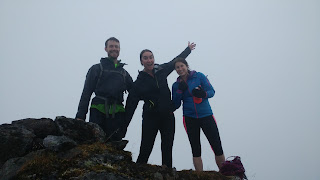
Though the west side of Powerline Pass is a fairly steep cirque, the east side is a gently sloping meadow, at least till the trail drops off and descends precipitously to Indian. Avalanche Mountain hikers will bypass the meadow and subsequent descent, and instead head straight up Avalanche’s ridge from the pass. For the first 750 vertical feet or so, the climbing is very easy, up a broad ridge of diminutive tundra plants and bands of scree. There is a faint path that other humans have used. This broad ridge narrows, and then the trail clings to the southeast side of the mountains spine as it winds past small pinnacles and across gullies. Continue climbing, and look for a well-defined goat trail that often is about 50 feet below the top of the ridge. At several places, you may be a couple hundred feet below the ridge to cross gullies. These gullies are the most confusing area in mist. If there’s a chance of it being socked in, take a GPS to ensure you make your way to the top of Avalanche’s 5,050 foot summit.
It is little more than a mile from Powerline Pass to the top of Avalanche, with about 1,500 feet of climbing. That represents approximately half of the total elevation gain from Glen Alps. Fit biker/hikers can get from Glen Alps to Powerline Pass in about an hour. Visibility will determine how fast the walking goes. Expect the hike to take about about an hour each way if you’re in the clouds, which is often the case in that area. Weather from the Portage area often seems to get hung up on the backside of the Front Range, which could mean it’s sunny at Glen Alps and storming on Avalanche. Overall, give yourself at least four hours round trip if you’re trying to go fast, or much more at a leisurely pace.
If you power all the way to the pass on bikes, the descent is particularly fast. The fairly short section of side-cut trail across Powerline’s south face feels like a desolate Andean highway that consumed all the buses that used to cross it, and now is populated solely by talus that has fallen from above. Once you’re past the side-cut trail, the grade mellows out and it’s a quick but relaxing ride back to Glen Alps.
Autumn’s golden palette provides a fine backdrop for Avalanche ascents. Fresh snow may dust the high peaks, and cold winds portend winter’s arrival. At the back of the Front Range, you overlook the full sweep of Chugach State Park, with its rarely visited interior that stretches toward Prince William Sound. There are few places where a short bike-and-hike provides a window into such limitless wilderness.


Comments
Post a Comment