Taku River
The Taku River has the largest roadless watershed between Seattle and Anchorage. From waterfalls of the Sloko River to its mouth at tidewater, the Taku’s massive drainage stretches from interior British Columbia to Southeast Alaska’s coastal rainforest. If they were near roads, each of the Taku’s major tributaries would be well-known destinations: The Sloko, which is born at the Llewellyn Glacier and drops over a waterfall hundreds of feet high before careening through canyons to the coast; the Sheslay, the Nakina, a Class V torrent that flows from remote mountains southwest of Teslin Lake; the Inklin, a huge watershed in itself that reaches to the boundaries of the Stikine.
 |
| Bare walls marking the retreat of East Twin Glacier |
However, since the upper Taku is so remote, few people ever paddle these tributaries. They are not convenient to anything: Accessing the Sloko under human power means skiing across the Juneau icefield or paddling dozens of miles across Atlin Lake before portaging into Sloko Lake. The Inklin and Nakina are even more remote, requiring long overland travel from some of British Columbia’s most isolated communities, such as Tahltan. It is precisely because of this wildness that the Taku River, including its headwater tributaries, is worth visiting.
 |
| Twin Glacier Lake |
The question is, how? A little-known guidebook entitled Paddling in the Yukon, by Ken Madsen and Peter Mather, is a good place to start. If you can’t find it online, call Mac’s Fireweed Books in Whitehorse and buy a copy. I’m not aware of any other guidebook to so many rivers in Northern British Columbia and the Yukon Territories, including major tributaries of the Taku. Paddling from anywhere close to the Taku’s headwaters is challenging because all of its tributaries cut through deep, incised gorges. The Sloko requires, at minimum, portaging a waterfall that is hundreds of feet high. Miles of challenging rapids lie downstream, though some packrafters have worked their way down them at extreme low water in the early season, after breakup but before significant snowmelt. The Nakina is reportedly extremely difficult (Class IV-VI with mandatory portages), and would require frequent and difficult portages. The Sheslay River, which flows into the Inklin, is more manageable (Class III-IV), and the most common route to explore the Taku watershed.

The Sheslay originates in a series of lakes near the northern border of the Stikine River watershed. Float planes can drop off paddlers in this area; Mike Ward, owner of the Taku Lodge, is a good source of information on flight logistics. For drop-offs in other parts of the watershed, Coastal Helicopters is a good option, since their A-Stars can land on gravel bars at numerous points along the river. Your schedule, as much as your wallet, may dictate the choice of floatplane vs helicopter: During periods of higher runoff, including much of the summer in an average year, the Class III Sheslay can be very pushy, with significant waves and holes, above its confluence with the Nahlin River.

The confluence of the Sheslay and Nahlin marks the beginning of the Inklin River. The Inklin is generally flat, although higher water can create very large, powerful whirlpools and holes at multiple points along the river. If you’re travelling in packrafts, it is definitely advisable to bring zippered boats and pack gear inside to maintain a low center of gravity. After planning for powerful, turbulent water, the upper Taku is a joy to explore. Far from coastal rain, a mountainous tapestry of meadows and aspen forests rise above the river. Gravel bars and lightly wooded banks provide luxurious camping. Ideally, camp near the numerous cliffs along the river to look for mountain goats. In addition to numerous goats, look for wolves and bear. Prior to salmon arriving this high up the river, bear tend to stay up in the hills, which is convenient for camping and wildlife viewing.
 |
| West Twin Glacier seen from upstream |
The upper Taku basin is much easier country for hiking, compared to the brushier lower watershed. The mountains are steep in sections, particularly along the river, but generally have areas with open, hikable meadows leading toward the alpine.
Approximately a day’s float above the Taku (and a couple hours downstream of its confluence with the Sutlahine River), the Inklin slices through a series of gorges. Floating toward each of these canyons would be extraordinarily intimidating if you did not know what was downstream: Their outlets are not visible, and the rock walls push closer and closer to one another, constricting the river into great roiling eddies and whirlpools. Canyon walls rise hundreds of feet overhead, in a palette of Southwest orange, red, and umber hues.

The rivers’ currents are swift in the upper Taku watershed. Excepting portages on the harder (or impassable) rivers, expect to float at six or seven miles per hour. This pace provides plenty of time to explore, watch wildlife, and fish. The current’s pace is so fast that it is difficult to take in the scenery, but it’s worth making an effort to do so because the Taku’s character changes dramatically just a dozen miles downstream.
 |
| The Inklin River passes through a deep canyon before joining the Nakina to form the Taku. |
“Taku” appears on maps where the Sloko and Nakina Rivers converge in Canada, miles upstream but just a few hours float from coastal rainforest. Shortly below this confluence, the aquamarine Taku joins the silt-laden Inklin, forming a massive coastal river that flows another fifty miles or so to the coast south of Juneau. The lower Taku is a place of explosive life and energy. At each confluence of a freshwater tributary, hundreds if not thousands of salmon and dolly varden roil the milky boundary of glacial and clear waters.

Rainforest crowds the hillsides, with spruce and western hemlock growing to dizzying heights on hillsides and old moraines. Glaciers surge from the icefield above, through rocky chasms, knocking down trees and pushing up new moraine on the banks of the Taku. Low clouds and mist obscure waterfalls that leap off of hillsides, course down cirques, and plunge riverward through boulder-choked canyons.
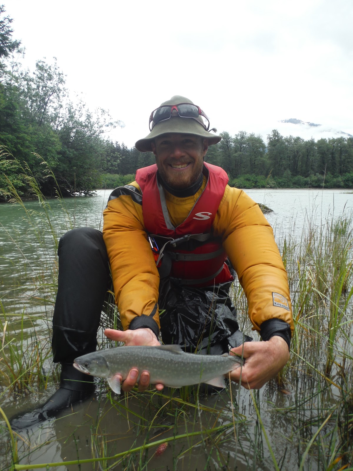
Like a continent unbound by railroads and highways, each stream contains the infinite promise of untrammeled headwaters, of remote alpine lakes that the salmon know and we don’t. This is an unbelievable country to fish. Even novice blunderers can catch dozens of dolly varden, trout, pink, and silver salmon at the mouths of just about any freshwater tributary entering the Taku downstream of the border. Improbably, there is very little guided sportfishing in this area, despite an abundance of fish and unrivalled scenery.
There aren’t just lakes and glaciers that lie upstream, however. Not far beyond the Canadian border, the Tulsequah River flows from the toe of a large Juneau icefield glacier. On its banks, the derelict Tulsequah Chief Mine leaches acid into the waters that flow downstream into the Taku.
As bountiful as the Taku’s waters are today, they pale in comparison to the recent past. King salmon fishing has nearly disappeared in the watershed, though it is unclear whether that is a result of ocean acidification’s impact on food stocks, global warming’s impact on sea temperatures and oxygen concentrations, toxic pollution from Tulsequah Chief, or some combination thereof.
The Tulsequah Chief Mine’s acid drainage is an apt summation of British Columbia’s fisheries, mining, and environmental policy. For years, the British Columbia government has recklessly permitted mines directly upstream of Southeast Alaska’s billion dollar fisheries. The most recent transboundary mining disaster--the Mount Polley blowout of 2014, which released 6.6 billion gallons of toxic mine waste into the Fraser River--went unpunished as a result of flaccid oversight by British Columbia. In fact, British Columbia granted the Mount Polley mine owners permission to another transboundary mine just six months after the Mount Polley disaster.
In 2016, Alaska’s Congressional delegation urged the State Department to protect Alaska’s fisheries from effectively unregulated mines in British Columbia, and the Obama Administration began working toward that objective. But the election of a dysfunctional Trump administration now means that the State Department almost certainly will not stop mines like New Polaris, Big Bull, and Hat from threatening the Taku’s fisheries. That is tragic, because international campaigns have protected Alaska’s coastal rivers in the past. British Columbia would have permitted a massive copper mine in the Tatshenshini-Alsek watershed, but a sustained campaign with strong American support resulted in that watershed’s permanent protection.
As a result of salmon that still spawn in the Taku basin, you will pass a couple fish camps on the Canadian side of the border. Shortly downstream, below a short canyon, a couple dozen large cabins line the riverbank, in an area with private land inholdings within the Tongass National Forest. This area is the hardest of the trip to find good camping, due to substantial reaches of private land. Near the end of most of these cabins, the Wright River flows into the Taku on the left. Surprisingly, the open forest on the floodplain east of the Wright River makes it possible to walk up to the Wright Glacier’s terminal lake in just a couple hours, with minimal bushwhacking. The Wright Glacier is visible several miles away, having retreated significantly from the point you find marked on maps.
While salmon still run up the Taku, while glaciers still flow to tidewater, while clouds from the North Pacific still drift through ice-bound cirques, take time to visit the Taku. Just a few miles above tidewater, two glaciers descend from the Juneau Icefield to Twin Glacier Lake. The lake is about a quarter mile from the Taku, separated only by an old moraine. Packrafts or canoes can ascend (with difficulty) the stream that flows from lake to river. Rafters could tie up at the confluence and walk up to Twin Glacier Lake. Several islands cluster around the mouth of the lake, and provide unobstructed views of the glaciers and mountains beyond. Paddling around the lake, up near East and West Twin Glaciers, takes a whole day. Be aware of winds that could make travel slow or dangerous, and the calving faces of the glaciers. Contrary to what maps suggest, these glaciers (particularly West Twin) will not touch the lake surface for long. They are thinning and retreating rapidly, leaving behind vast, bare rock escarpments.
While it is possible to paddle back to Juneau from the Taku, most paddlers will prefer to fly back from Taku Lodge on a “deadhead” flight. These flights are cheap, and generally available every day during the summer. Taku Lodge’s manager Mike Ward is very supportive of paddlers, so call ahead and figure out the logistics for your trip.
A journey down the Taku feels like a trip into an entirely different time, verdant and primordial. The fish are so thick that it isn’t clear whether you are seeing them or the water. On the boundary of the glacial Taku and a clearwater tributary, the fish flit in and out, their silhouettes moving across the eddy lines in such number that it seems the riverbed or river itself is in motion. Downstream just a few miles, a great wall of ice--Hole in the Wall Glacier, a branch of the Taku Glacier--comes into view. Had you been descending the river for the first time, you would wonder what would happen when a massive river crashes into an equally imposing wall of fluid ice. The enchantment, and much of the ice, remain: Cosseting the river against massive cliffs. Flowing into Twin Glacier Lake. Being born, with every snowfall, in the high reaches of the Juneau Icefield.
Most of the Juneau Icefield’s glaciers are retreating at a breathtaking pace. The Mendenhall is melting so quickly that the changes are clearly visible over a calendar year. It is hard to comprehend that the glacier nearly reached the Forest Service visitor center when it was constructed a half-century ago, or that there was no lake at the toe of the glacier when white people were settling the Mendenhall Valley. Neighboring glaciers from the icefield, such as Herbert and Eagle, are melting away as well. The Eagle is leaving behind a deep gorge where an icy tongue once descended to its eponymous outlet lake.
Compared to these, the Taku Glacier is an outlier. Its toe has advanced in recent years, though the glacier is still losing mass as it thins. As a Juneau pilot explained to me, the Taku is like an ice cream cone melting on a hot day: The fact that it’s spreading out doesn’t mean it is growing.
Nonetheless, the Taku is surreal to behold. Anyone who has spent time in Alaska is accustomed to a certain type of glacial topography: Bare rock walls, piles of moraine no longer near the ice, lateral moraines of talus that crumble down after the ice has disappeared. These vacant landscapes are like empty coffins, left behind when the departed left the scene even before her family members could organize a wake.
In contrast, its thinning notwithstanding, the Taku Glacier appears healthy. Jumbles of spruce trees, knocked over by surging ice, border the glacier’s toe and portions of its low elevation lateral moraine. A great expanse of heavily crevassed cerulean ice reaches clear to the Taku’s tidal reaches, pushing up a pile of rocks between itself and the river. The Taku fills the valley it carved brimful, unlike the vacant canyons left behind by so many other departed glaciers.
When you see the Taku, look again. It is unlikely that another generation will ever see it like this.
The Taku is a remarkable glacier in that it captures such a large volume of the Juneau Icefield. Its tributary glaciers form miles away, behind the Mendenhall Towers and the other high peaks of the icefield. The bulk of the Taku Glacier bends northeast, then east, then south as it slides off polished rock on its slow course from alpine heights to tidewater. Since the Taku’s accumulation zone is so large, and is at a relatively high elevation, it has been more resistant to retreat than neighboring glaciers like the Mendenhall. Compare the ratio of accumulation to ablation zones of the Taku and the Mendenhall, respectively. It explains a great deal about the Mendenhall’s breathtaking retreat, and the Taku’s relative resilience.
Other glaciers of the Juneau Icefield are not so fortunate. Twin Glacier Lake receives meltwater from East and West Twin Glaciers, which form on the icefield adjacent to the Taku Glacier. The lake was once ice, and the glacier’s then-massive toe pushed a massive pile of moraine up against the Taku River. Today, that moraine pile dams up the lake, which is separated from the river by a short slough. The lake is approximately three miles in diameter, with a constellation of islands near its outlet. These islands have some of the best camping in Alaska, with panoramic views of East and West Twin Glaciers, and the lake in the foreground.
The islands provide evidence of the glaciers’ power: Dozens of feet back into spruce forest, you will find large rocks that were cast into the woods from waves created by glacial calving miles away. The waves that tossed these rocks through spruce trees had to be massive, and lashed the shores of both islands and Twin Glacier Lake.
Today, it is clear that the age of glacial calving on the lake has nearly ended. West Twin Glacier barely reaches the lake. A thin band of ice still reaches down from the glacier, but bare rock separates much of the glacier from the lake’s surface. Most calving events are small. The glacier’s toe is a mile or so farther back than indicated by the map. Huge bathtub rings on the cliffs overhead mark the glacier’s thinning--clearly, it was a couple thousand feet thicker in the very recent past.
East Twin Glacier’s retreat is even more stark. Its bedrock is red, unlike the grey stone underlying West Twin. East Twin’s drainage is different as well, a narrow gorge in contrast to West Twin’s broad valley. Today, lower East Twin Glacier is a dirty, thin trickle of ice stagnating a deep rocky gorge. The glacier’s calving face is very narrow, and the bare redrock walls attest that it was orders of magnitude wider and higher just a few years ago. Looking farther up the glacier’s canyon, it appears that East Twin is on the verge of separating. The lower glacier has thinned so much that it reveals a massive cliff wall, over which seracs from the upper glacier calve and cascade. While the active upper glacier can offset some of the lost ice of the lower glacier for a time, the near future likely will bring a separation in the glacier, and even more rapid stagnation and melting of lower East Twin.
Southeast Alaska used to have many glaciers that descended to sea level, either to tidewater like the Taku or (roughly) sea level lakes such as Twin Glacier Lake or Shakes Lake. Reading descriptions of Southeast explorers from just a hundred years ago is disorienting, since they describe so many more glaciers that descend to tidewater. Today, Southeast’s tidewater glaciers are an endangered species. Many, like East and West Twin, are retreating quickly up valley, leaving behind barren canyons. The Taku is one of very few, along with Margerie Glacier in Glacier Bay National Park, with a stable terminus.
From the perspective of a human time scale, these glaciers are disappearing forever. Your children will not see them in anything resembling their present state, if they see them at all. So take a trip to see them now--call it extinction tourism. You can charter a float plane or helicopter from Juneau to drop you off on the beach by West Twin Glacier, on the edge of the lake. Paddle around the lake for a day, camping at the larger island in the middle of the lake’s outlet. The next day, paddle down the slough to the Taku River, then take out at Taku Lodge and hop on the deadhead flight back to Juneau.
It may be your last chance to say goodbye.

Rainforest crowds the hillsides, with spruce and western hemlock growing to dizzying heights on hillsides and old moraines. Glaciers surge from the icefield above, through rocky chasms, knocking down trees and pushing up new moraine on the banks of the Taku. Low clouds and mist obscure waterfalls that leap off of hillsides, course down cirques, and plunge riverward through boulder-choked canyons.
Like a continent unbound by railroads and highways, each stream contains the infinite promise of untrammeled headwaters, of remote alpine lakes that the salmon know and we don’t. This is an unbelievable country to fish. Even novice blunderers can catch dozens of dolly varden, trout, pink, and silver salmon at the mouths of just about any freshwater tributary entering the Taku downstream of the border. Improbably, there is very little guided sportfishing in this area, despite an abundance of fish and unrivalled scenery.
There aren’t just lakes and glaciers that lie upstream, however. Not far beyond the Canadian border, the Tulsequah River flows from the toe of a large Juneau icefield glacier. On its banks, the derelict Tulsequah Chief Mine leaches acid into the waters that flow downstream into the Taku.
As bountiful as the Taku’s waters are today, they pale in comparison to the recent past. King salmon fishing has nearly disappeared in the watershed, though it is unclear whether that is a result of ocean acidification’s impact on food stocks, global warming’s impact on sea temperatures and oxygen concentrations, toxic pollution from Tulsequah Chief, or some combination thereof.
The Tulsequah Chief Mine’s acid drainage is an apt summation of British Columbia’s fisheries, mining, and environmental policy. For years, the British Columbia government has recklessly permitted mines directly upstream of Southeast Alaska’s billion dollar fisheries. The most recent transboundary mining disaster--the Mount Polley blowout of 2014, which released 6.6 billion gallons of toxic mine waste into the Fraser River--went unpunished as a result of flaccid oversight by British Columbia. In fact, British Columbia granted the Mount Polley mine owners permission to another transboundary mine just six months after the Mount Polley disaster.
In 2016, Alaska’s Congressional delegation urged the State Department to protect Alaska’s fisheries from effectively unregulated mines in British Columbia, and the Obama Administration began working toward that objective. But the election of a dysfunctional Trump administration now means that the State Department almost certainly will not stop mines like New Polaris, Big Bull, and Hat from threatening the Taku’s fisheries. That is tragic, because international campaigns have protected Alaska’s coastal rivers in the past. British Columbia would have permitted a massive copper mine in the Tatshenshini-Alsek watershed, but a sustained campaign with strong American support resulted in that watershed’s permanent protection.
As a result of salmon that still spawn in the Taku basin, you will pass a couple fish camps on the Canadian side of the border. Shortly downstream, below a short canyon, a couple dozen large cabins line the riverbank, in an area with private land inholdings within the Tongass National Forest. This area is the hardest of the trip to find good camping, due to substantial reaches of private land. Near the end of most of these cabins, the Wright River flows into the Taku on the left. Surprisingly, the open forest on the floodplain east of the Wright River makes it possible to walk up to the Wright Glacier’s terminal lake in just a couple hours, with minimal bushwhacking. The Wright Glacier is visible several miles away, having retreated significantly from the point you find marked on maps.
While salmon still run up the Taku, while glaciers still flow to tidewater, while clouds from the North Pacific still drift through ice-bound cirques, take time to visit the Taku. Just a few miles above tidewater, two glaciers descend from the Juneau Icefield to Twin Glacier Lake. The lake is about a quarter mile from the Taku, separated only by an old moraine. Packrafts or canoes can ascend (with difficulty) the stream that flows from lake to river. Rafters could tie up at the confluence and walk up to Twin Glacier Lake. Several islands cluster around the mouth of the lake, and provide unobstructed views of the glaciers and mountains beyond. Paddling around the lake, up near East and West Twin Glaciers, takes a whole day. Be aware of winds that could make travel slow or dangerous, and the calving faces of the glaciers. Contrary to what maps suggest, these glaciers (particularly West Twin) will not touch the lake surface for long. They are thinning and retreating rapidly, leaving behind vast, bare rock escarpments.
While it is possible to paddle back to Juneau from the Taku, most paddlers will prefer to fly back from Taku Lodge on a “deadhead” flight. These flights are cheap, and generally available every day during the summer. Taku Lodge’s manager Mike Ward is very supportive of paddlers, so call ahead and figure out the logistics for your trip.
A journey down the Taku feels like a trip into an entirely different time, verdant and primordial. The fish are so thick that it isn’t clear whether you are seeing them or the water. On the boundary of the glacial Taku and a clearwater tributary, the fish flit in and out, their silhouettes moving across the eddy lines in such number that it seems the riverbed or river itself is in motion. Downstream just a few miles, a great wall of ice--Hole in the Wall Glacier, a branch of the Taku Glacier--comes into view. Had you been descending the river for the first time, you would wonder what would happen when a massive river crashes into an equally imposing wall of fluid ice. The enchantment, and much of the ice, remain: Cosseting the river against massive cliffs. Flowing into Twin Glacier Lake. Being born, with every snowfall, in the high reaches of the Juneau Icefield.
Most of the Juneau Icefield’s glaciers are retreating at a breathtaking pace. The Mendenhall is melting so quickly that the changes are clearly visible over a calendar year. It is hard to comprehend that the glacier nearly reached the Forest Service visitor center when it was constructed a half-century ago, or that there was no lake at the toe of the glacier when white people were settling the Mendenhall Valley. Neighboring glaciers from the icefield, such as Herbert and Eagle, are melting away as well. The Eagle is leaving behind a deep gorge where an icy tongue once descended to its eponymous outlet lake.
Compared to these, the Taku Glacier is an outlier. Its toe has advanced in recent years, though the glacier is still losing mass as it thins. As a Juneau pilot explained to me, the Taku is like an ice cream cone melting on a hot day: The fact that it’s spreading out doesn’t mean it is growing.
Nonetheless, the Taku is surreal to behold. Anyone who has spent time in Alaska is accustomed to a certain type of glacial topography: Bare rock walls, piles of moraine no longer near the ice, lateral moraines of talus that crumble down after the ice has disappeared. These vacant landscapes are like empty coffins, left behind when the departed left the scene even before her family members could organize a wake.
In contrast, its thinning notwithstanding, the Taku Glacier appears healthy. Jumbles of spruce trees, knocked over by surging ice, border the glacier’s toe and portions of its low elevation lateral moraine. A great expanse of heavily crevassed cerulean ice reaches clear to the Taku’s tidal reaches, pushing up a pile of rocks between itself and the river. The Taku fills the valley it carved brimful, unlike the vacant canyons left behind by so many other departed glaciers.
When you see the Taku, look again. It is unlikely that another generation will ever see it like this.
The Taku is a remarkable glacier in that it captures such a large volume of the Juneau Icefield. Its tributary glaciers form miles away, behind the Mendenhall Towers and the other high peaks of the icefield. The bulk of the Taku Glacier bends northeast, then east, then south as it slides off polished rock on its slow course from alpine heights to tidewater. Since the Taku’s accumulation zone is so large, and is at a relatively high elevation, it has been more resistant to retreat than neighboring glaciers like the Mendenhall. Compare the ratio of accumulation to ablation zones of the Taku and the Mendenhall, respectively. It explains a great deal about the Mendenhall’s breathtaking retreat, and the Taku’s relative resilience.
Other glaciers of the Juneau Icefield are not so fortunate. Twin Glacier Lake receives meltwater from East and West Twin Glaciers, which form on the icefield adjacent to the Taku Glacier. The lake was once ice, and the glacier’s then-massive toe pushed a massive pile of moraine up against the Taku River. Today, that moraine pile dams up the lake, which is separated from the river by a short slough. The lake is approximately three miles in diameter, with a constellation of islands near its outlet. These islands have some of the best camping in Alaska, with panoramic views of East and West Twin Glaciers, and the lake in the foreground.
The islands provide evidence of the glaciers’ power: Dozens of feet back into spruce forest, you will find large rocks that were cast into the woods from waves created by glacial calving miles away. The waves that tossed these rocks through spruce trees had to be massive, and lashed the shores of both islands and Twin Glacier Lake.
Today, it is clear that the age of glacial calving on the lake has nearly ended. West Twin Glacier barely reaches the lake. A thin band of ice still reaches down from the glacier, but bare rock separates much of the glacier from the lake’s surface. Most calving events are small. The glacier’s toe is a mile or so farther back than indicated by the map. Huge bathtub rings on the cliffs overhead mark the glacier’s thinning--clearly, it was a couple thousand feet thicker in the very recent past.
East Twin Glacier’s retreat is even more stark. Its bedrock is red, unlike the grey stone underlying West Twin. East Twin’s drainage is different as well, a narrow gorge in contrast to West Twin’s broad valley. Today, lower East Twin Glacier is a dirty, thin trickle of ice stagnating a deep rocky gorge. The glacier’s calving face is very narrow, and the bare redrock walls attest that it was orders of magnitude wider and higher just a few years ago. Looking farther up the glacier’s canyon, it appears that East Twin is on the verge of separating. The lower glacier has thinned so much that it reveals a massive cliff wall, over which seracs from the upper glacier calve and cascade. While the active upper glacier can offset some of the lost ice of the lower glacier for a time, the near future likely will bring a separation in the glacier, and even more rapid stagnation and melting of lower East Twin.
Southeast Alaska used to have many glaciers that descended to sea level, either to tidewater like the Taku or (roughly) sea level lakes such as Twin Glacier Lake or Shakes Lake. Reading descriptions of Southeast explorers from just a hundred years ago is disorienting, since they describe so many more glaciers that descend to tidewater. Today, Southeast’s tidewater glaciers are an endangered species. Many, like East and West Twin, are retreating quickly up valley, leaving behind barren canyons. The Taku is one of very few, along with Margerie Glacier in Glacier Bay National Park, with a stable terminus.
From the perspective of a human time scale, these glaciers are disappearing forever. Your children will not see them in anything resembling their present state, if they see them at all. So take a trip to see them now--call it extinction tourism. You can charter a float plane or helicopter from Juneau to drop you off on the beach by West Twin Glacier, on the edge of the lake. Paddle around the lake for a day, camping at the larger island in the middle of the lake’s outlet. The next day, paddle down the slough to the Taku River, then take out at Taku Lodge and hop on the deadhead flight back to Juneau.
It may be your last chance to say goodbye.

Comments
Post a Comment