Alaska Range Traverse, Richardson Highway to Parks Highway
After a long time Wilderness Classic organizer told Charlie Procknow that the Alaska Range Traverse (aka Black Rapids to McKinley Village) was his favorite route, Charlie prioritized it for a summer trip and I was lucky to have time to go in the summer of 2023. This is a spectacular route, and it's logical to visit for a week-long trip since so little can be reasonably visited with trips of shorter duration.
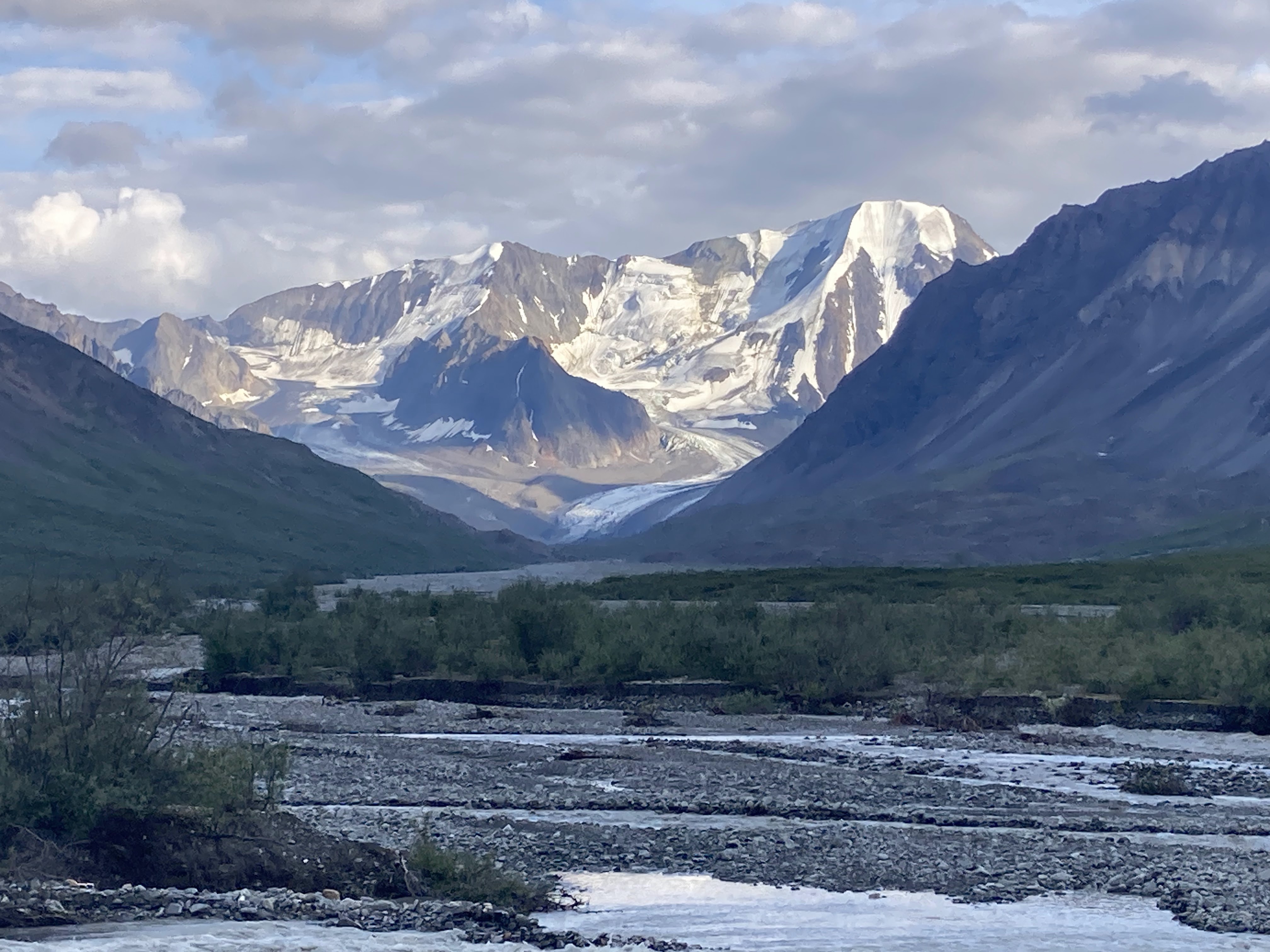
To research the trip, we referred to helpful blog posts by Kellie Okonek and Andrew Skurka. To see a synthesis of their routes in map form, visit this Caltopo link. As far as we could tell, most of Skurka's narrative remains accurate, with the exception that retreat of the Hayes Glacier makes a glacial crossing of Hayes Creek highly inconvenient; instead, plan on either ferrying or fording the creek shortly downstream of its new terminus, where a short stretch of flat(ish) water makes crossing possible.
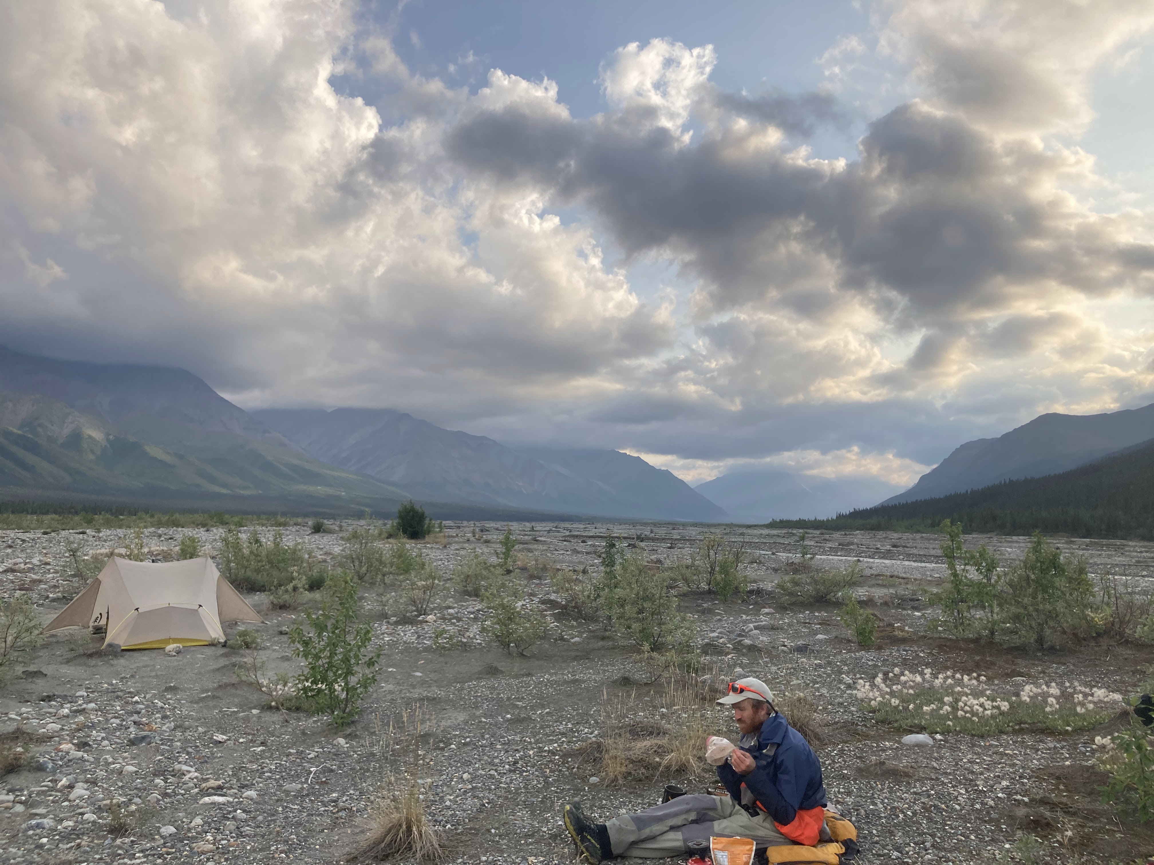
We hiked and paddled the route in early August following what seems to have been a warm, dry year in that part of the Interior. Water was high from glacial runoff, and highland bogs seemed drier and firmer than I would have expected. Hot weather brought ripe blueberries early.
If you're considering doing this trip, a few key takeaways I'd recommend are:
1. Use that ATV trail at the start of the route from McGinnis Creek up onto the plateau; it is a fast route to the high country and incredible walking beneath the high peaks.
2. Give yourself at least a couple hours to cross the Trident and Hayes Glaciers, which are receding and thinning. Expect complex moraine, steep ice, and potential for tricky crossings of surface water on ice.
3. You may need to ferry across the Delta, Hayes and Little Delta Rivers to cross safely (we did)...effectively this means you have to carry a packraft, and means it's impractical to arrange a packraft drop at the Yanert Strip, unless you're doing this trip into the fall when you're sure cold temps have significantly dropped water levels.
4. There's a fine balance between pack weight and taking time at breaks and campsites to absorb the views...We hiked and paddled this route in seven days, generally walking with food breaks from about 9am to 7pm or 8pm each day. In a sense, I'd want to spend two weeks on this route, since there are so many outstanding campsites and scenic vistas that demand appreciation. But the miles of tussocks, low brush, cobble walking, and glacier crossings would make heavier packs hard to endure.
5. The ascent of Big Grizzly Creek and descent to the Yanert are among the lowest elevation and brushiest portions of the trip, so it is worth your while to find and try to stay on the horse trail. From the Wood River, look for the trail near the rim of the tall cut bank where Big Grizzly Creek swings from flowing north to northwest. Find the trail again on the Yanert side as you approach brushline, again focusing near the rim of Edgar Creek's deep canyon.
6. The whitewater on the Yanert River is significant enough below the Moose Creek confluence that you need a drysuit and PFD, and very solid Class III+ boating skills, unless you're certain the river is going to be very low (i.e. freezing temperatures for much of the night, which is a tough thing to forecast if you're starting the trip a week before you get to the Yanert). While the lower Yanert is mostly fun Class II with large holes that are easy to dodge, a couple harder rapids near the confluence with the Nenana are challenging if you're running them for the first time.


Comments
Post a Comment