Talkeetna Traverse, Chickaloon to Talkeetna including Talkeetna Canyon
I've wanted to do a Talkeetna range traverse for many years, and have always enjoyed fall paddling down the Talkeetna canyon. So in 2024 Charlie Procknow and I decided to make a south-to-northwest traverse, starting from the Glenn Highway, putting in way up on the Talkeetna River, and paddling all the way down through both the high country and the canyon to end in Talkeetna.
Since the canyon has serious whitewater that is essentially unnavigable in packrafts at most summer flows, we went in September with the hopes that cold temperatures up high would reduce glacial discharge, but also be early enough that snow wouldn't make the passes impossible to cross on the way into the river. We were watching water levels closely with the goal of heading out Saturday September 7th, and conditions seemed favorable as cooling temperatures brought the gauge down to 6,400 cfs a few days before our planned departure. Then, the day before we were supposed to leave, NWS forecast "cyclonic flows" into the Talkeetnas for midweek, with a projected spike in water levels. With that evolving forecast, we figured we needed to be on the water by Wednesday to beat the incoming storms and descend the canyon at a safe level. Rather than head into the Talkeetna with a more circuitous route from Boulder Creek, we walked straight up the Chickaloon River route.
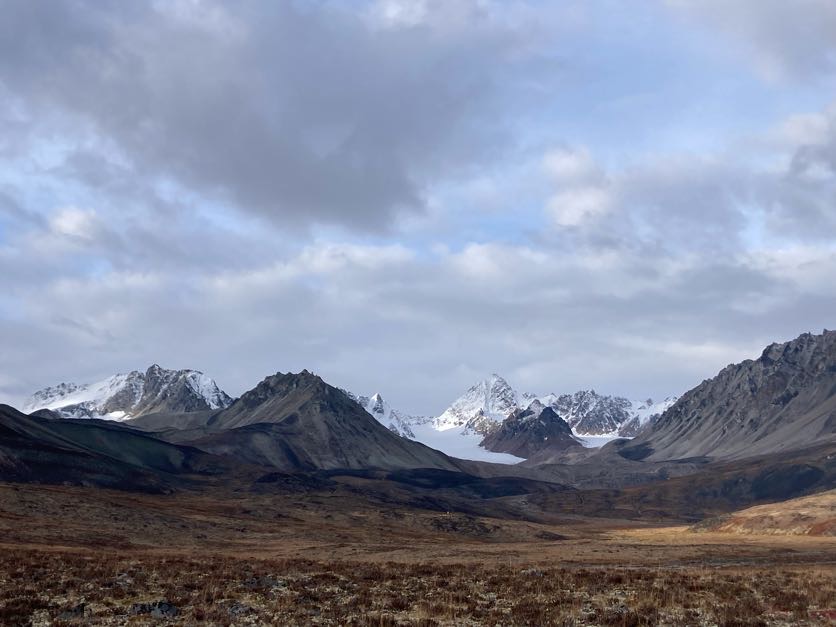
I hadn't hiked into the Chickaloon in autumn in several years, and had pretty much forgotten what a spectacular valley it is with fall colors. Huge peaks adjacent to the river soar above blazing yellow birches and smoldering red blueberries and willows. To our surprise, the Chickaloon and Talkeetna basins held a huge supply of ripe blueberries, as frost apparently hadn't come yet to lower elevations. There is lovely beach camping from 13 mile and upstream, as the horse trail swings down to river level and mostly stays there. The horse trail is in decent condition, and continues even beyond where it is marked on old USGS quads. A couple miles north of Moss Creek, it does meander away from the river and up a ridgeline, perhaps for access to alpine caribou hunting. Once you're a couple miles of Moss Creek, you'll reach a point it makes more sense to follow the river bars straight upstream. When the river swings against the west bank of the river, which cliffs out, go ahead and ford (or paddle) across to the east bank. From this point, the river seems to stick to the east bank cliffs closely, and bushwhacking above them would be difficult or impossible. In contrast, it's easy to walk the east bank gravel bars up to the pass connecting over to the Talkeetna.

Looking back south down the Chickaloon
The game trail up to the pass is a caribou super highway, and should be visible even from the river valley below. Follow it up the steep but climbable nose, ascending pass brush line and then tundra to crest out amidst lichen-covered rocks on the nicest rock-paved caribou trail you've ever encountered. The trail follows a beautiful and improbable catwalk over a rock promontory before landing on a high, flat tundra bench. Continue north on the caribou trail toward the lake at the pass between the Chickaloon and Talkeetna drainages. There are two steep gorges which at first glance seem potentially impassible, but follow those caribou tracks and climb into and out of both of them before the mellow final stroll to the lake.


Lake at the pass with spectacular hike options all around
This lake and surrounding peaks are a worthy destination for base camping and summit ascents, but our timeline didn't allow us to linger. It took us two days to get from Chickaloon to the lake at the pass. The next morning, we walked north, following the north-facing tundra nose to put in where the main stem Talkeetna River meets the tributary that flows out of the pass at the lake. Note that both the Talkeetna and the smaller drainage to the east flow through canyons, so the tundra nose seems to be the best walking route. Only the final descent to the river is steep; look for game trail(s) that thread through cliffs right at the nose's northern terminus.

From here, it is a swift, relaxing float of Class I and flatwater down to the Talkeetna Canyon. Paddlers flying in can talk with Talkeetna Air Taxi about flying into the Buck Stewart airstrip, which is a couple hours upstream of Prairie Creek.
We put in on the upper Talkeetna around 12:30pm and took out at a nice campsite a mile above Prairie Creek around 7pm. There are three more good rock bar campsites between Prairie Creek and the canyon, and below those are more marginal campsites at the head of at least four islands that precede the canyon. Finally, at low-ish water (7,500 and below) there's a beach with camping right below Entrance Exam rapid, although like any beach in a canyon, it is more at risk of rapidly rising water if there's significant runoff from upstream.
After camping above Prairie Creek, it took us about an hour and a half to float and leisurely paddle down to Entrance Exam. We were entering the Talkeetna Canyon at about 8,2000 cfs, which in retrospect is as much water as I'd want to packraft it. We portaged Entrance Exam, which had a large spruce wedged in the slot canyon downstream of it. Make sure to scout the entire slot canyon before you enter it, including downstream of where it makes a 90 degree turn. With our two-person group, we also portaged Toilet Bowl, where the standard left-to-right route looked both like the best line and pretty challenging. We ran all the rapids afterward.
At 8,200 cfs, there's still a few miles of flat-ish water downstream of the four rapids that start with Entrance Exam. Then the rapids pick back up, with three Class III+ rapids before the large double ledge rapid that I just know as "the third" (and difficult) rapid. At lower flows, this left-bending rapid naturally leads paddlers onto a center-left tongue that threads between large holes on the left and truly nasty holes on the right. At 8,000 cfs+, I found the rapid very hard to read and run--as I approached it, a giant hole seemed to stretch across the middle of the river, so I kept looking right for an opening. There was a small slot that Charlie and I made it through (for me, messily). Looking back, the whole rapid appears enormous, with higher water merging the two ledges into one massive pourover. There is still a bit of a tongue on the left, but it's unclear if the hole at the bottom of it is passable. I think I'd scout carefully if running this rapid again at 8,000+ cfs.
From double ledege, the rapids are nearly continuous for approximately 10 miles. Some of the most challenging are in a gorge-within-a-gorge, whose entrance is marked by a sharp left bend with a huge banked wall of water that rides up on the right cliff wall and crashes into massive holes. Since this rapid is not visible on the approach, we grabbed a left eddy and scouted it as well as the gorge downstream. We entered the rapid left on a tongue and then worked through offset holes that reminded me of a much, much higher-volume version of Six Mile's Nozzle rapid. This mini-gorge was barely controllable at 8,200 cfs, and I suspect even slightly higher flows would create packraft-destroying holes that could be difficult or impossible to avoid.
There are miles more rapids, most III+ in character with some that might be fairly called IV-. The continuous and swift nature of the water, estimated velocity 10mph, means that paddlers really shouldn't swim and that rescue of packrafters plus gear could be difficult or impossible. The holes are large enough you shouldn't count on being able to self-rescue. Anyone running the Talkeetna at this level needs to be completely comfortable on Class IV+ water. At water levels of 5,000 and below, the Talkeetna Canyon is much more forgiving, as the rapids are not continuous and there's far greater opportunity for rescue and gear recovery.
I think it only took an hour for us to paddle the 10 miles or so of continuous rapids. Stopping at the end for a break and looking back up the canyon was disorienting, dizzying, like we just stepped out of the most immersive dream state.
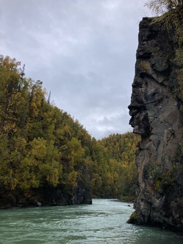
The Talkeetna Canyon has long been my favorite fall paddle in Alaska. Shockingly intense colors, azure water, and miles of ultra-high quality whitewater make it an absolute must-visit destinations for paddlers ready for Class IV wilderness exploration.

Comments
Post a Comment